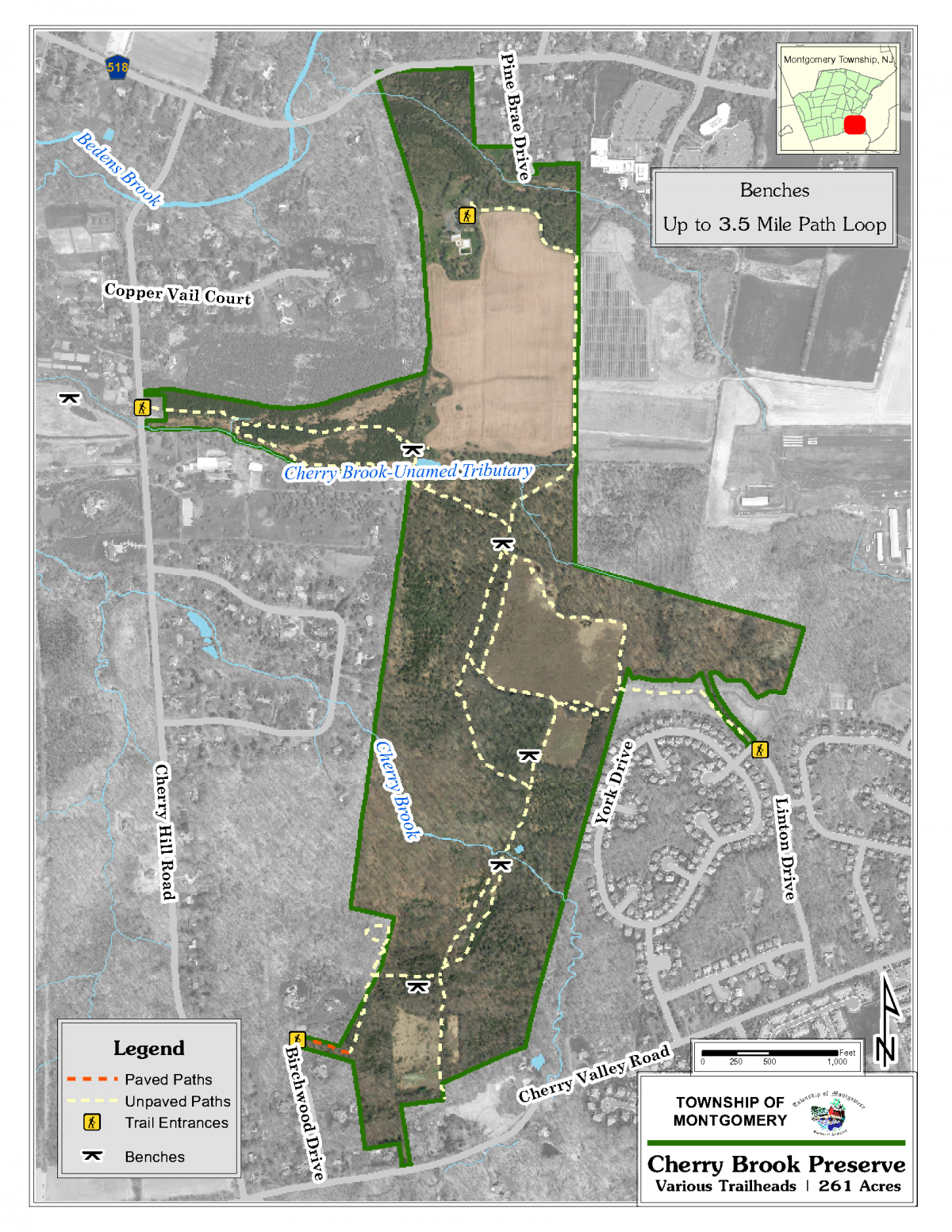
Cherry Brook Preserve is identified as Cherry Hill Road Pathways on the map. There are four access points to this preserve, which consists of over 400 acres and 3.5 miles of pathways!
Access on Cherry Hill Road: The trailhead parking is on the east side of the road near the Waldorf School. The pathway west of Cherry Hill Road is a 9/10 mile loop which includes a walk back along Cherry Hill Road to trailhead parking. The east side of Cherry Hill Road has a loop of 8/10 miles from the trailhead parking area using Uplands Trail to the pond and the Lowlands Trail coming back. Further along, there are other trails that intersect.
Access on Pine Brae Drive
Access Pine Brae Drive from Route 518. Take the right fork toward Lenape Swim Club. There is a small parking area with a split rail fence marking the trailhead. The gravel path meanders along the edge of the farm field, and then into the trails in the woods.
Access on Cherry Valley Road
There are two (2) other access points from Cherry Valley Road to different parts of the Preserve, located at the end of Birchwood Drive and Linton Drive where parking is along the street.